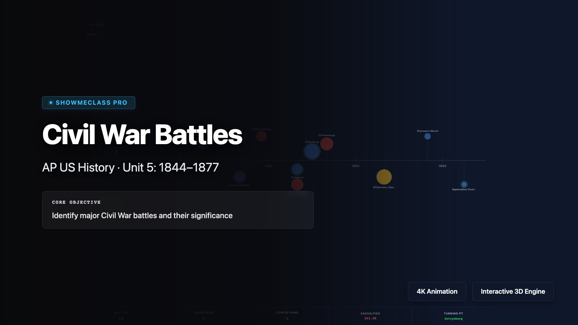
Civil War Battles – AP US History
Interactive visualization for Civil War Battles – AP US History in AP US HISTORY.
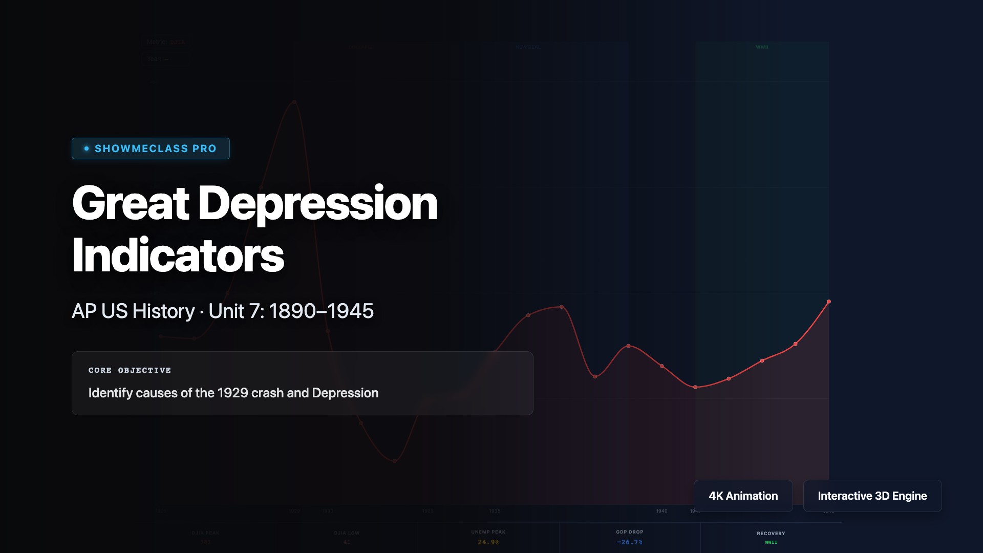
Great Depression Indicators – AP US History
Interactive visualization for Great Depression Indicators – AP US History in AP US HISTORY.

Immigration Waves – AP US History
Interactive visualization for Immigration Waves – AP US History in AP US HISTORY.
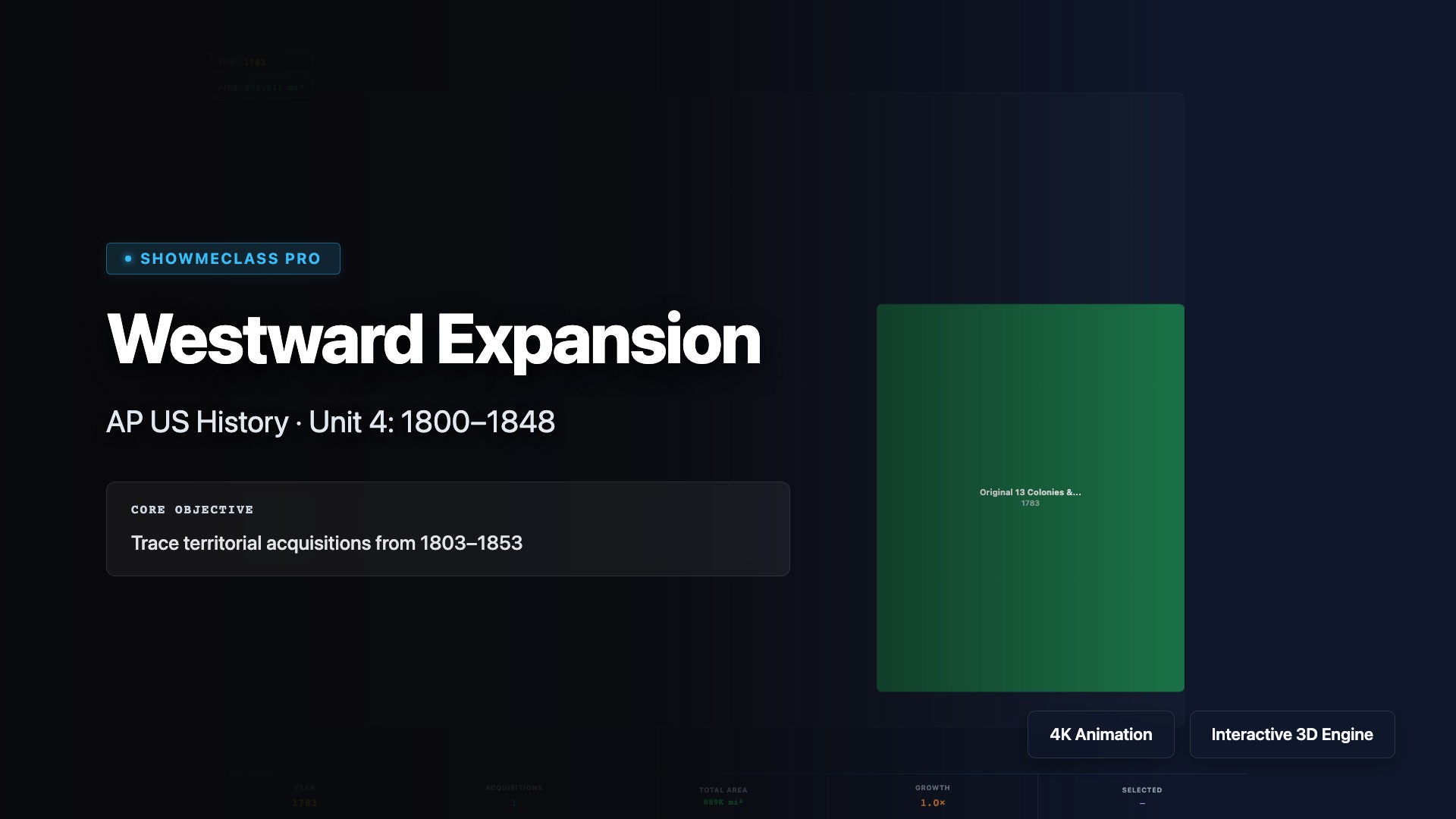
Westward Expansion – AP US History
Interactive visualization for Westward Expansion – AP US History in AP US HISTORY.
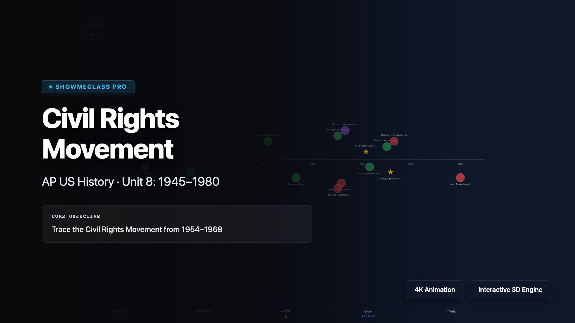
Civil Rights Movement – AP US History
Interactive visualization for Civil Rights Movement – AP US History in AP US HISTORY.
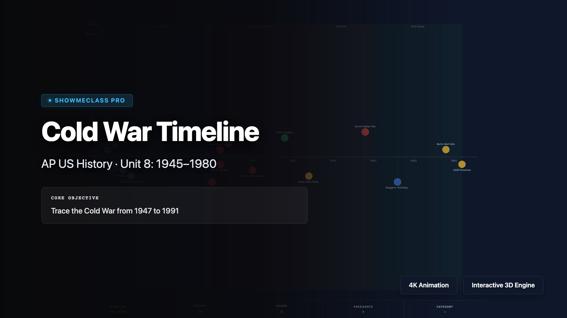
Cold War Timeline – AP US History
Interactive visualization for Cold War Timeline – AP US History in AP US HISTORY.

Territorial Expansion Map (1783-1898)
Interactive timeline map covering the territorial expansion of the United States. Move the time slider to witness the Manifest Destiny acquisitions, from the Louisiana Purchase to the Gadsden Purchase.
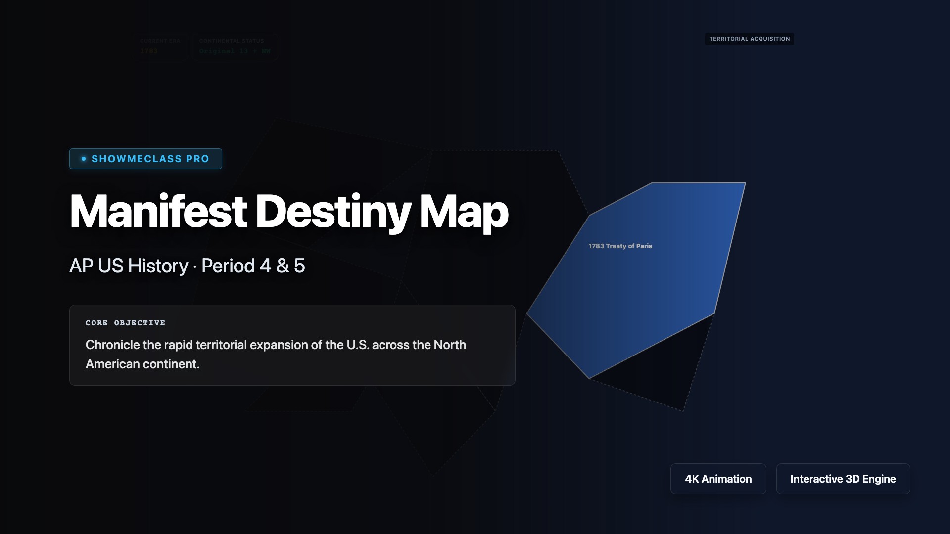
Manifest Destiny Map
Visualize the territorial expansion of the U.S. across North America and understand how each acquisition ignited debates over slavery.
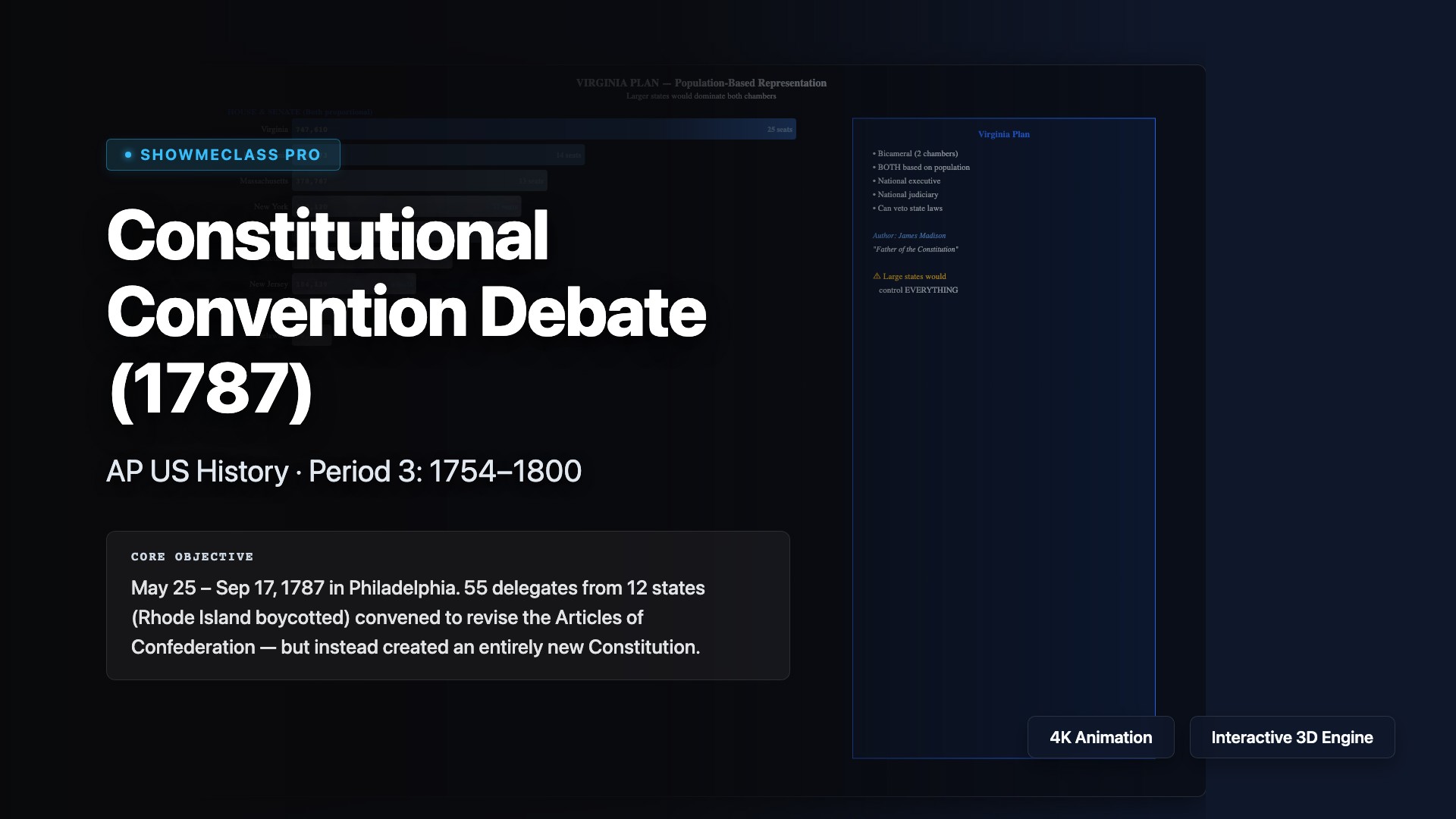
Constitutional Convention Debate (1787)
Interactive exploration of the 1787 Constitutional Convention with 5 debate panels: Virginia Plan (population-based representation), New Jersey Plan (equal votes), Great Compromise (bicameral solution), Three-Fifths Compromise (slavery and representation), and Separation of Powers (checks and balances). All historical dates, figures, and facts verified.
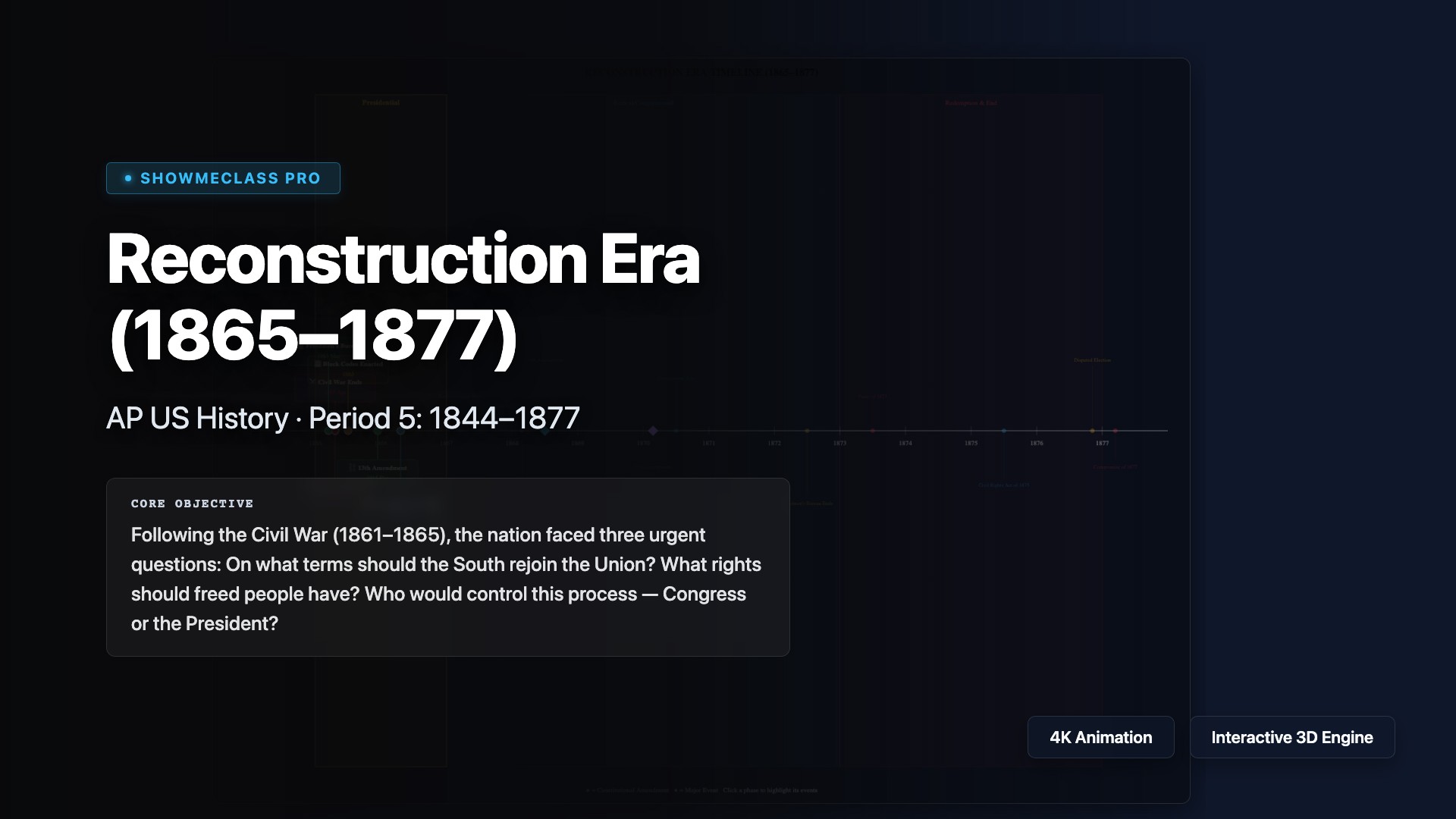
Reconstruction Era Timeline (1865–1877)
Comprehensive timeline of the Reconstruction Era with 16 verified historical events across 3 phases: Presidential Reconstruction (1865–67), Radical/Congressional Reconstruction (1867–73), and Redemption (1873–77). Covers the 13th, 14th, and 15th Amendments, Freedmen's Bureau, Black Codes, Johnson's impeachment, and the Compromise of 1877.

WWI: U.S. Involvement (1914–1918)
Interactive timeline tracing U.S. transition from neutrality to intervention in World War I. Covers 6 pivotal events: Wilson's Neutrality Declaration, Sinking of the Lusitania (128 Americans killed), Unrestricted Submarine Warfare, Zimmermann Telegram, Declaration of War, and the Armistice. Includes escalation meter, casualty data, and Treaty of Versailles context.
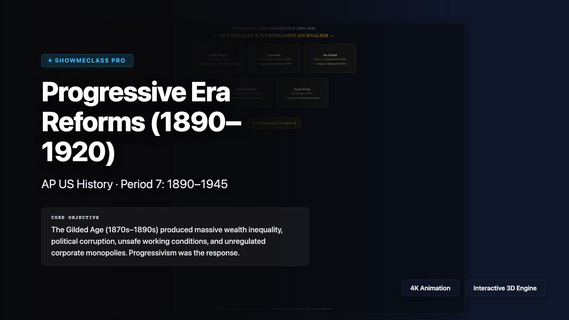
Progressive Era Reforms (1890–1920)
Interactive exploration of Progressive Era reforms organized into 4 categories: Muckrakers & Journalism (Sinclair, Riis, Tarbell), Trust Busting & Regulation (Sherman Act, NRA, FDA), Political Reforms (16th-17th Amendments, Initiative/Referendum/Recall), and Social Reforms (Triangle Fire, Suffrage, Temperance). Covers 20 verified reform items.
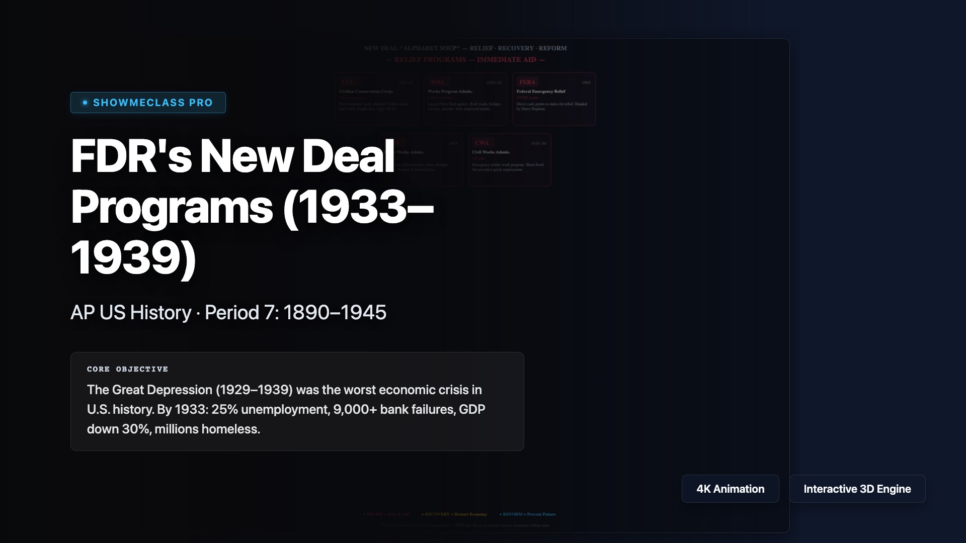
FDR's New Deal Programs (1933–1939)
Comprehensive visualization of New Deal 'Alphabet Soup' agencies organized by the Three R's framework: Relief (CCC, WPA, FERA, PWA, CWA), Recovery (NRA, AAA, TVA, HOLC, RFC), Reform (SSA, FDIC, SEC, Wagner Act, Glass-Steagall), and Opposition & Legacy (Long, Coughlin, Court-packing, New Deal Coalition). 20 verified programs with employment data.
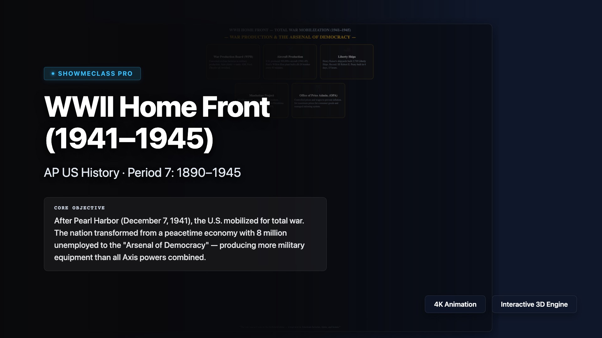
WWII Home Front (1941–1945)
Interactive exploration of the American WWII home front across 4 themes: War Production (WPB, Liberty Ships, Manhattan Project), Women & Labor (Rosie the Riveter, FEPC, WASP/WAC), Civil Liberties (EO 9066, Korematsu v. US, Double V Campaign, Zoot Suit Riots), and Daily Life (Rationing, Victory Gardens, War Bonds). 20 verified topics with statistics.
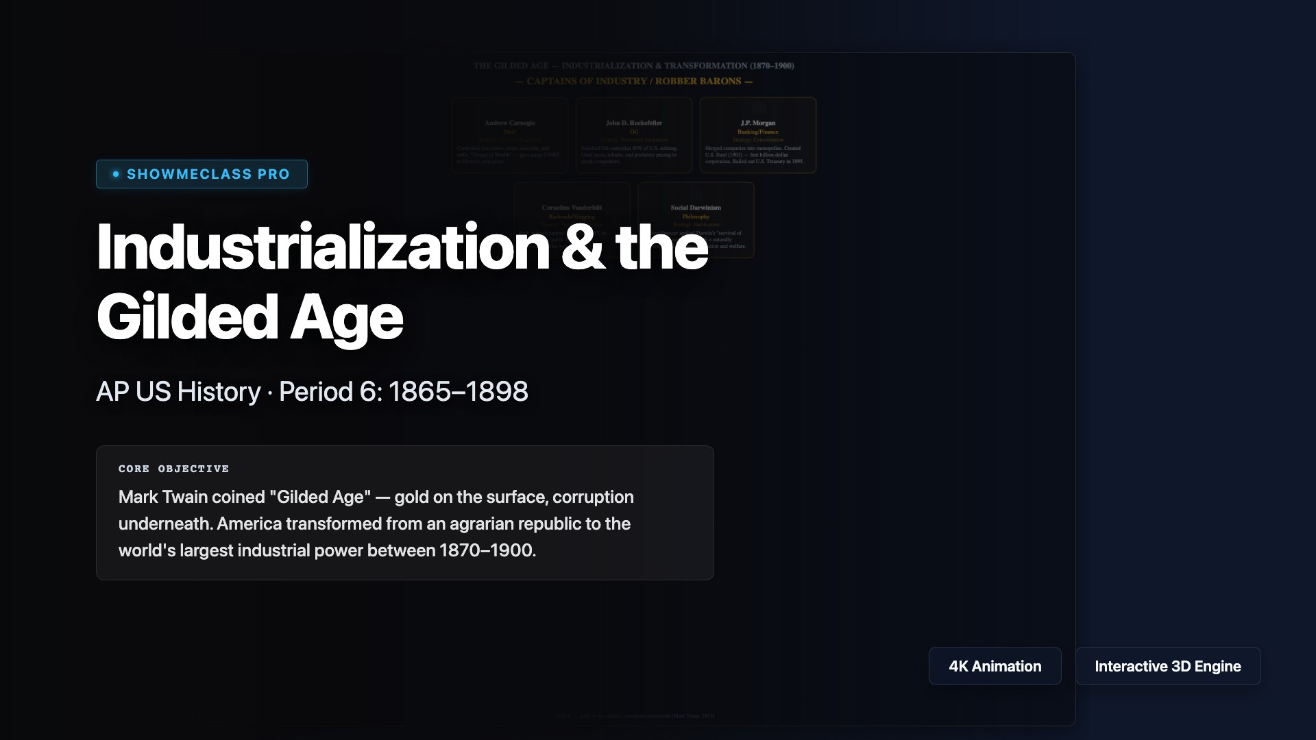
Industrialization & the Gilded Age (1870–1900)
Interactive exploration of the Gilded Age across 4 themes: Captains of Industry (Carnegie, Rockefeller, Morgan, Vanderbilt, Social Darwinism), Labor Movement (Knights of Labor, AFL, Haymarket, Pullman Strike, Homestead Strike), Urbanization & Immigration (New Immigration, Tenements, Political Machines, Chinese Exclusion Act, Settlement Houses), and Technology (Transcontinental Railroad, Edison, Bell, Bessemer Process).
Civil Rights Movement (1954–1968)
Interactive exploration of the Civil Rights Movement across 4 chronological phases: Legal Foundations (Brown v. Board, Montgomery Boycott, Little Rock Nine, Emmett Till), Direct Action (Sit-ins, Freedom Riders, Birmingham, March on Washington), Legislative Victories (Civil Rights Act 1964, Voting Rights Act 1965, Selma), and Black Power & Division (Malcolm X, Black Panthers, Urban Riots, MLK Assassination).
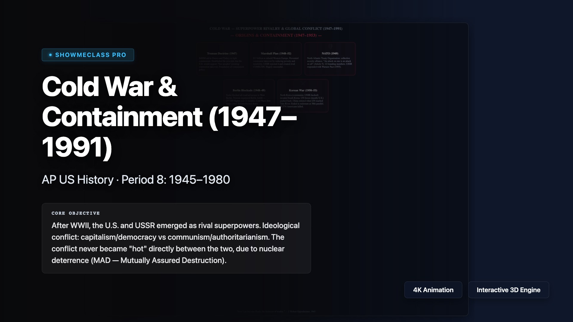
Cold War & Containment (1947–1991)
Interactive exploration of the Cold War across 4 phases: Origins & Containment (Truman Doctrine, Marshall Plan, NATO, Berlin Blockade, Korean War), Red Scare & Domestic (McCarthyism, HUAC, Rosenbergs, Loyalty Oaths, Military-Industrial Complex), Crises & Escalation (Sputnik, Cuban Missile Crisis, Berlin Wall, Vietnam, Hot Line), and Détente & End (Nixon/China, SALT, Reagan, Fall of Berlin Wall).

Vietnam War & 1960s Counterculture
Interactive exploration of the Vietnam War and 1960s across 4 themes: Escalation & War (Gulf of Tonkin, Tet Offensive, My Lai, Credibility Gap), Anti-War Movement (Draft Resistance, Kent State, Pentagon Papers), Counterculture & Society (Hippies, Woodstock, Women's Liberation, Great Society), and Vietnamization & End (Nixon, Paris Peace Accords, Fall of Saigon, War Powers Act).
Manifest Destiny & Westward Expansion
Interactive exploration of westward expansion across 4 themes: Territorial Acquisition (Louisiana Purchase, Texas, Mexican War, Oregon, Gadsden), Native American Removal (Indian Removal Act, Trail of Tears, Plains Wars, Little Bighorn, Dawes Act), Migration & Settlement (Oregon Trail, Gold Rush, Homestead Act, Railroad, Cowboys), and Slavery & Sectionalism (Missouri Compromise, Compromise of 1850, Kansas-Nebraska, Dred Scott, John Brown).
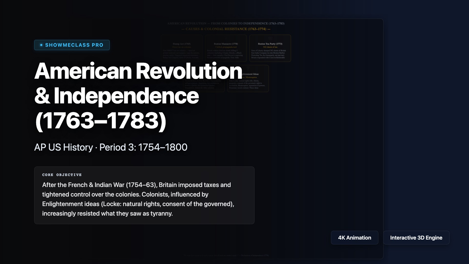
American Revolution & Independence (1763–1783)
Interactive exploration of the American Revolution across 4 phases: Causes & Resistance (Stamp Act, Boston Massacre, Tea Party, Intolerable Acts, Enlightenment), Road to Independence (Continental Congress, Lexington & Concord, Common Sense, Declaration of Independence), War & Turning Points (Saratoga, Valley Forge, Yorktown, French Alliance, Washington), and Revolution's Legacy (Treaty of Paris, State Constitutions, Global Influence, Revolution's Limits).