Urban Land Use Models – AP Human Geography
Interactive visualization for Urban Land Use Models – AP Human Geography in AP HUMAN GEOGRAPHY.
Interactive visualization for Urban Land Use Models – AP Human Geography in AP HUMAN GEOGRAPHY.
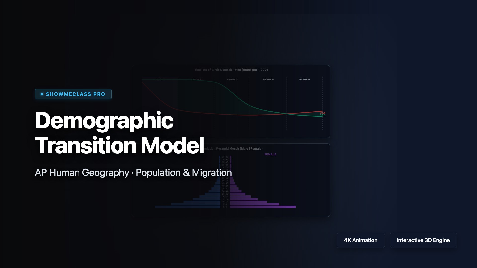
Scrub through the 5 stages of the Demographic Transition Model. Watch CBR, CDR, and Natural Increase shift while witnessing the real-time morphing of population pyramids.

Unlock Walter Christaller's urban model. Toggle Range and Threshold parameters across a hexagonal grid to understand the spatial distribution of hamlets, villages, towns, and massive Central Cities.

Visualize the forces of global migration. Set economic, political, and environmental push/pull factors, and watch how intervening obstacles and opportunities alter the migration stream.
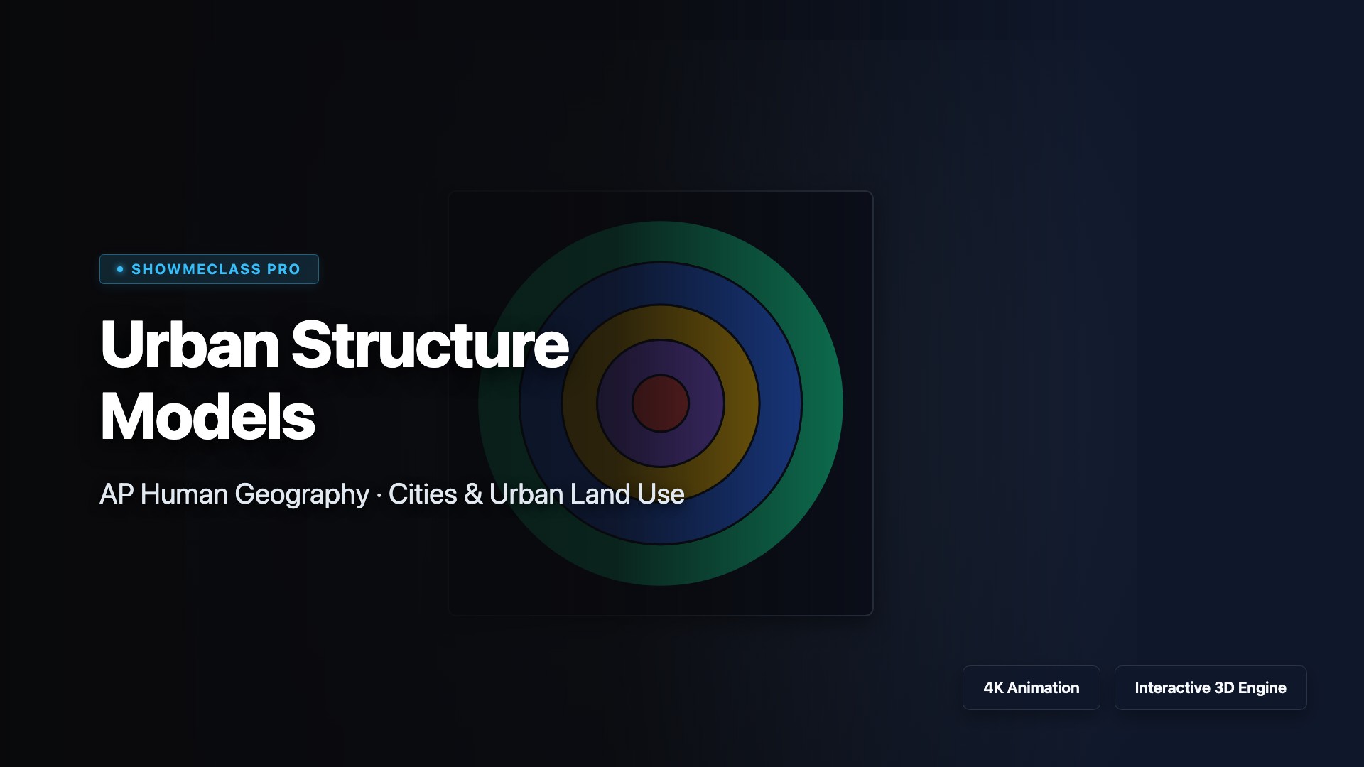
Compare the core North American urban models. Toggle between the Burgess Concentric Zone and Hoyt Sector models to understand socio-economic spatial layout.